Protect Your Farm with MAP DE FIRE
Advanced wildfire management for South African landowners and Real-time fire detection, instant alerts, and direct connection to local firefighting services.
Comprehensive Fire Management
MAP DE FIRE provides everything you need to protect your land from wildfires, from early detection to emergency response coordination.
Real-time Fire Detection
Advanced satellite monitoring and NASA FIRMS integration for instant fire detection and alerts.
Farm Boundary Mapping
Easily mark and save your farm boundaries with precise GPS coordinates for targeted monitoring.
Weather Integration
Real-time weather data, wind patterns, and Fire Danger Index to assess wildfire risk levels.
Emergency Alerts
Instant notifications when fires are detected near your property with direct emergency service contact.
Local Fire Services
Direct integration with district firefighting services for rapid emergency response coordination.
Community Network
Connect with nearby farms to share fire information and coordinate responses.
Proven Fire Management Experience
Our team has extensive experience in wildfire management across South Africa. See the real impact of effective fire prevention and response.
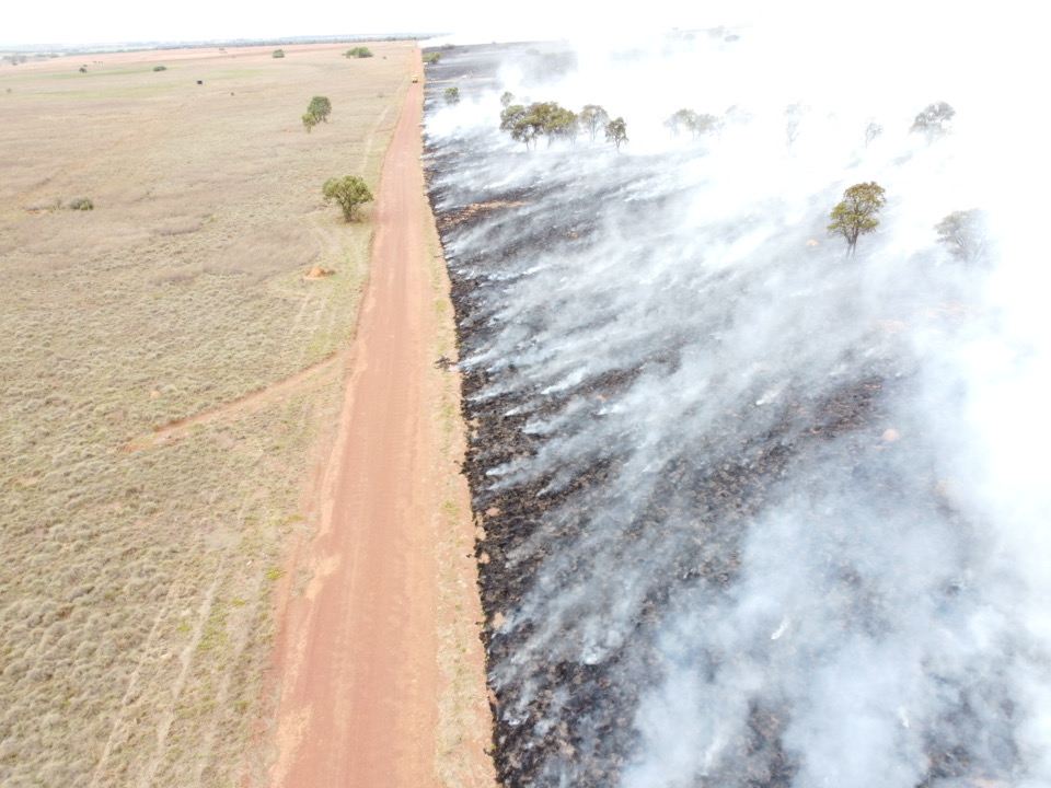
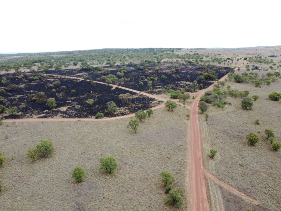
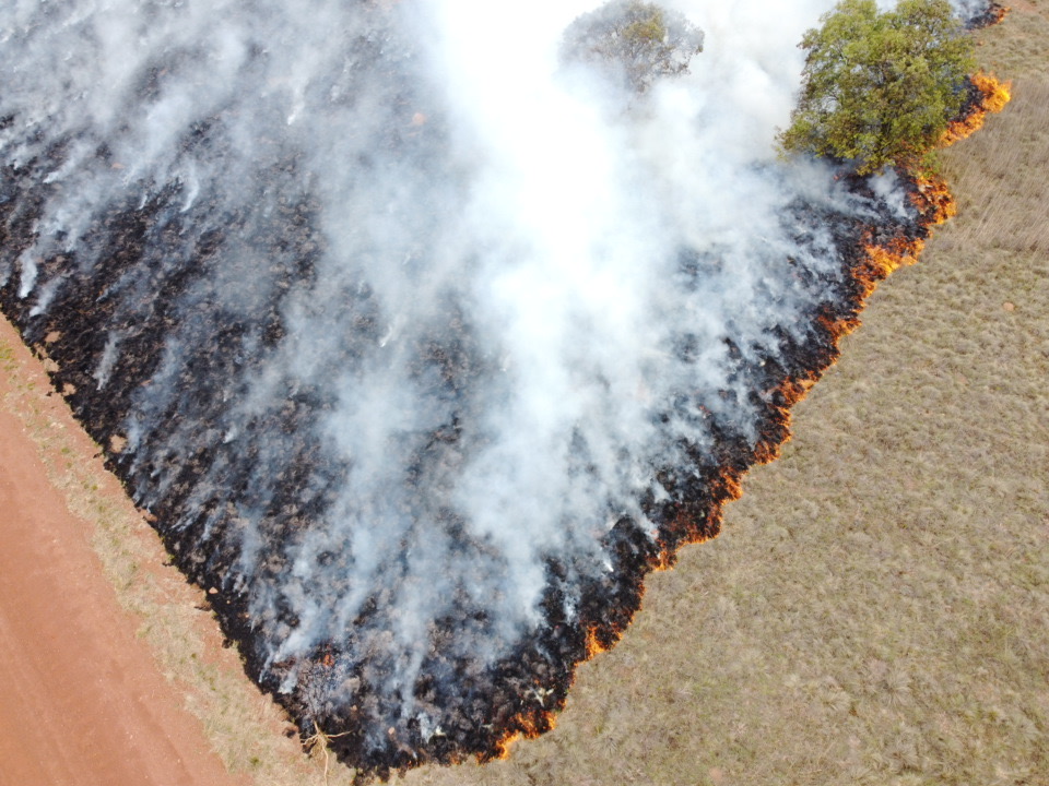
Effective Firebreaks Save Properties
This aerial image shows the critical importance of proper firebreaks. The cleared road acted as an effective barrier, stopping the fire from spreading to the protected farmland on the left while the right side was consumed by flames.
MAP DE FIRE helps you identify and plan these crucial fire prevention measures for your property.
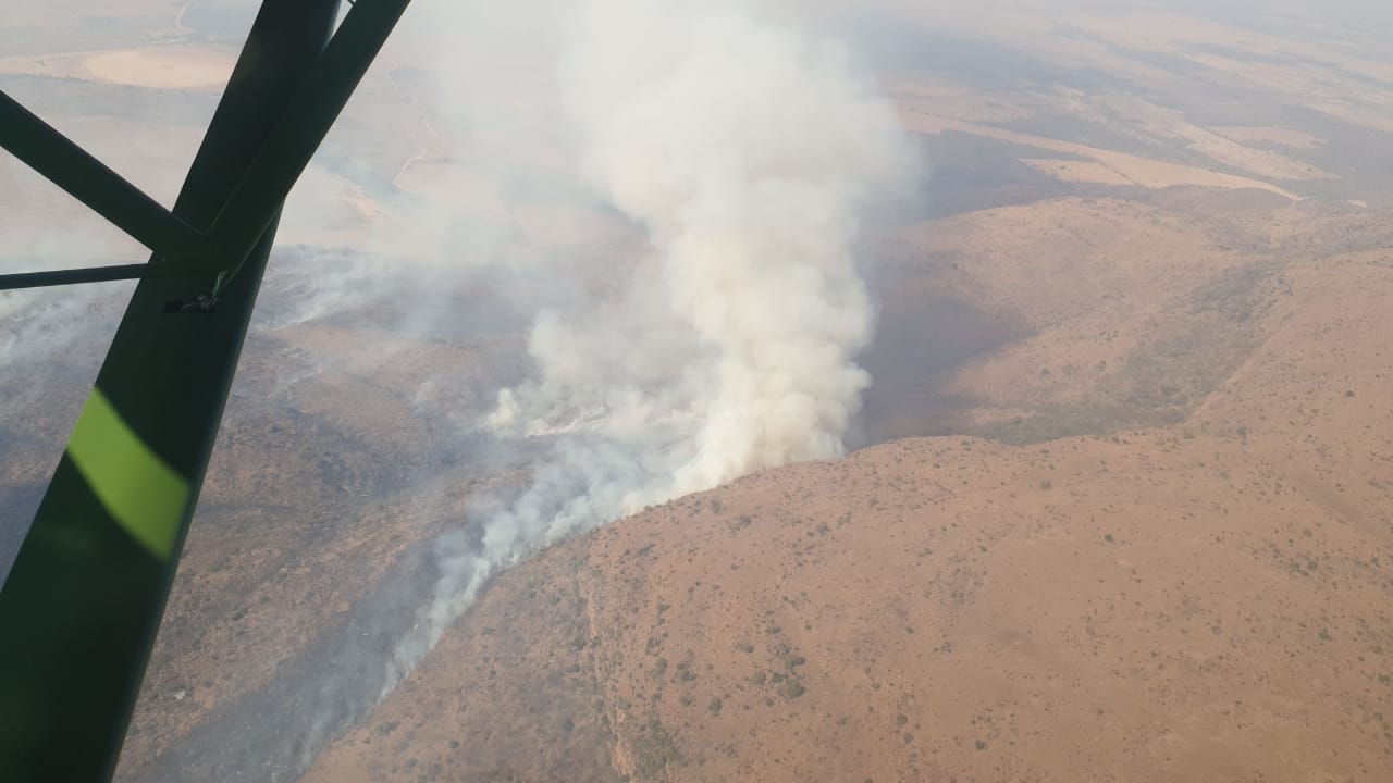
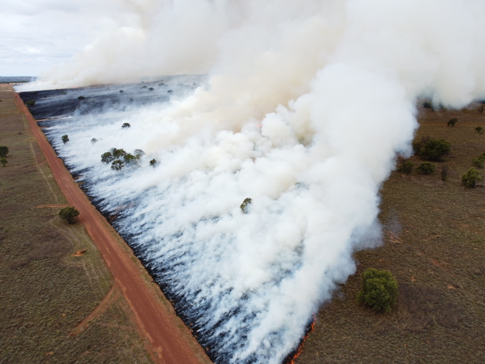
Professional Fire Response
Our team conducts aerial monitoring and coordinates with firefighting services to provide rapid response to wildfire incidents across South African farmlands.
With MAP DE FIRE, you get access to this same level of professional fire management expertise and coordination.
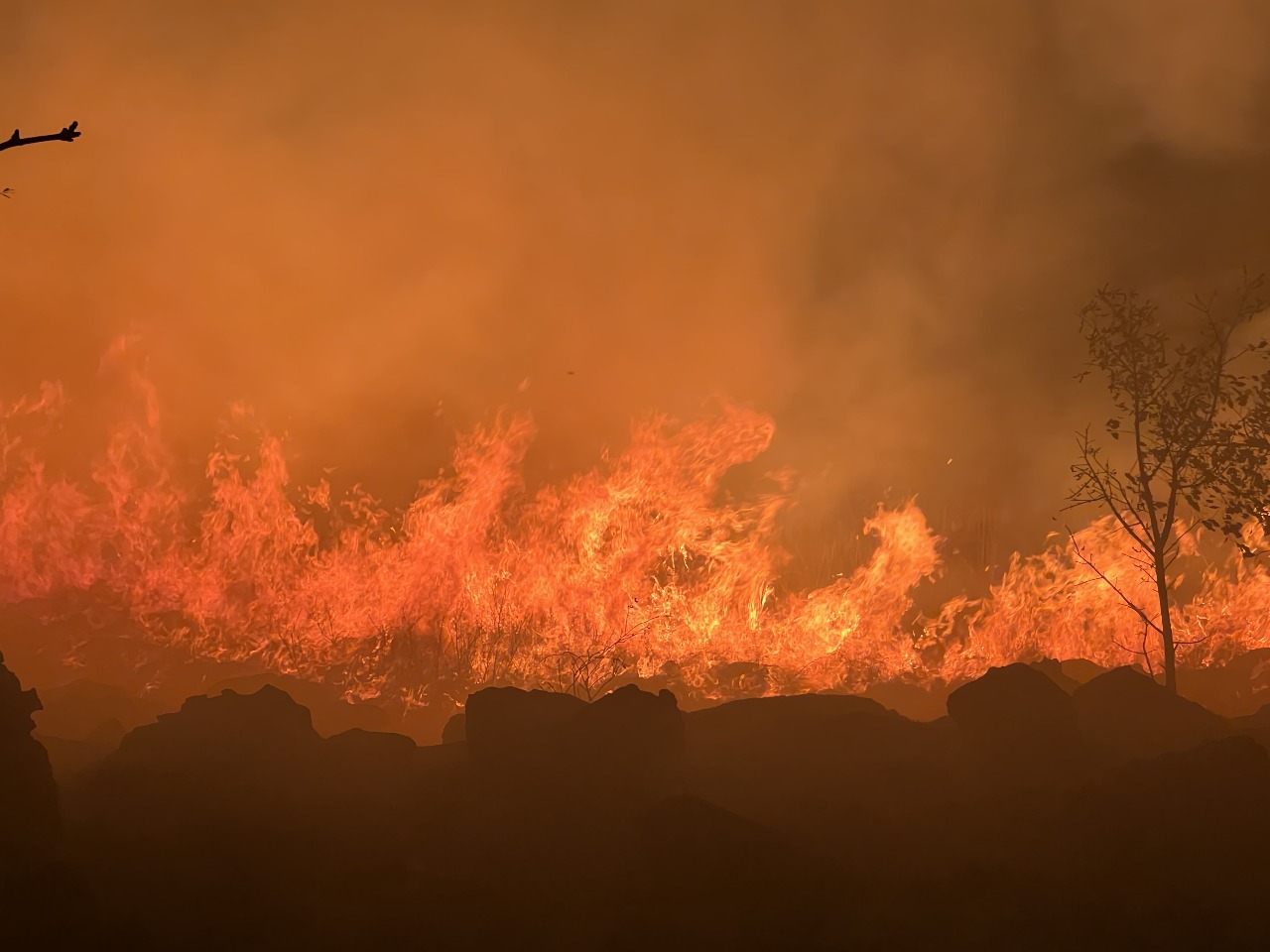
Night Fire Operations
24/7 monitoring and response
Controlled Burns
Preventive fire management
Fire Assessment
Post-incident analysis
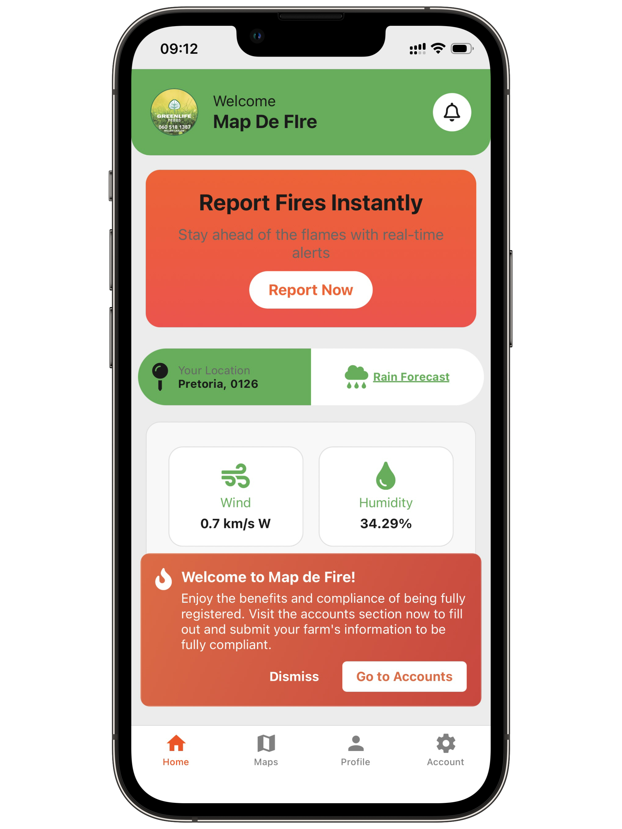
See MAP DE FIRE in Action
Explore the intuitive interface designed specifically for South African landowners
Dashboard Overview
Monitor fire danger levels, weather conditions, and quick actions
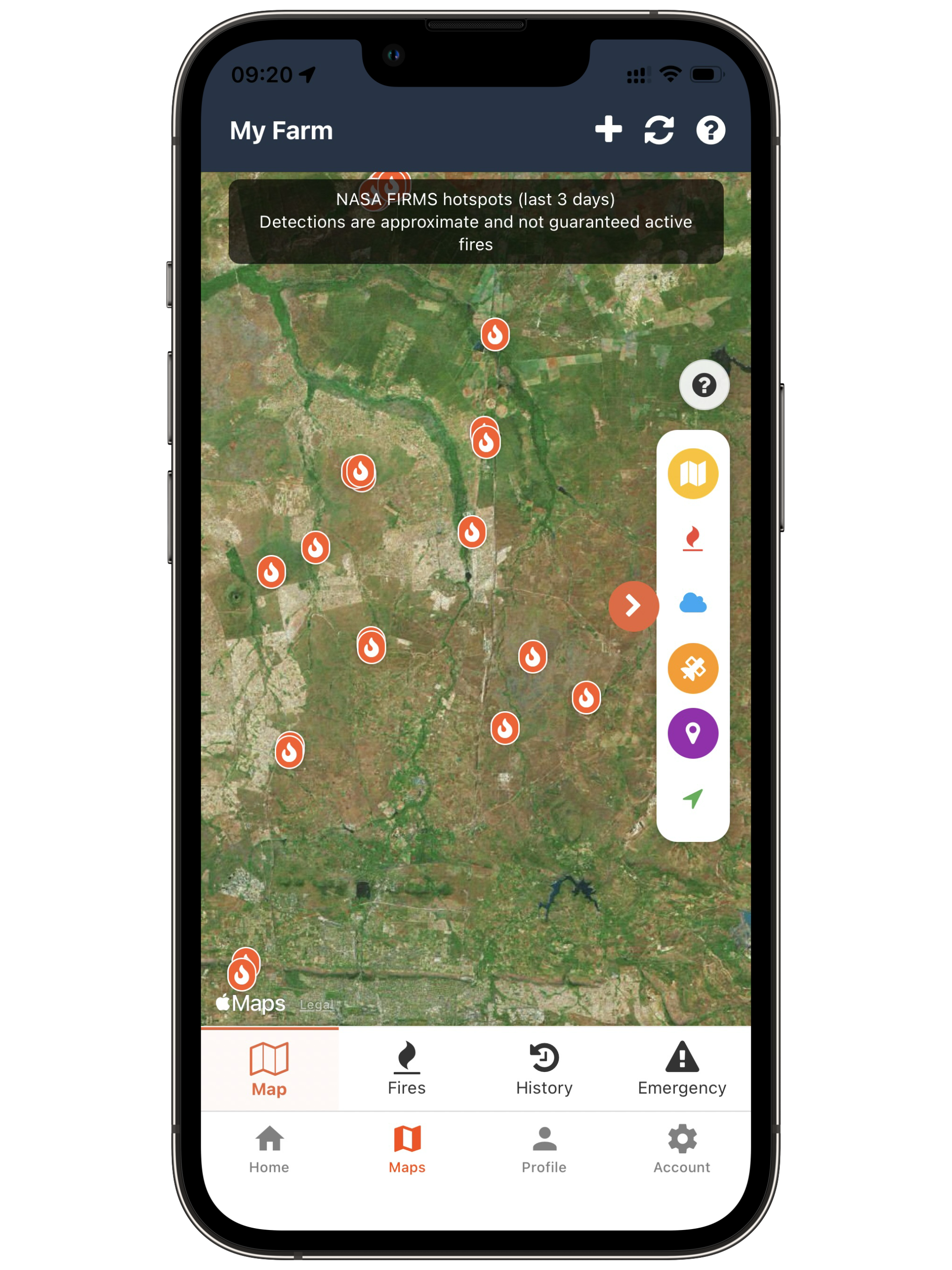
Interactive Maps
View your farm boundaries, fire hotspots, and weather overlays
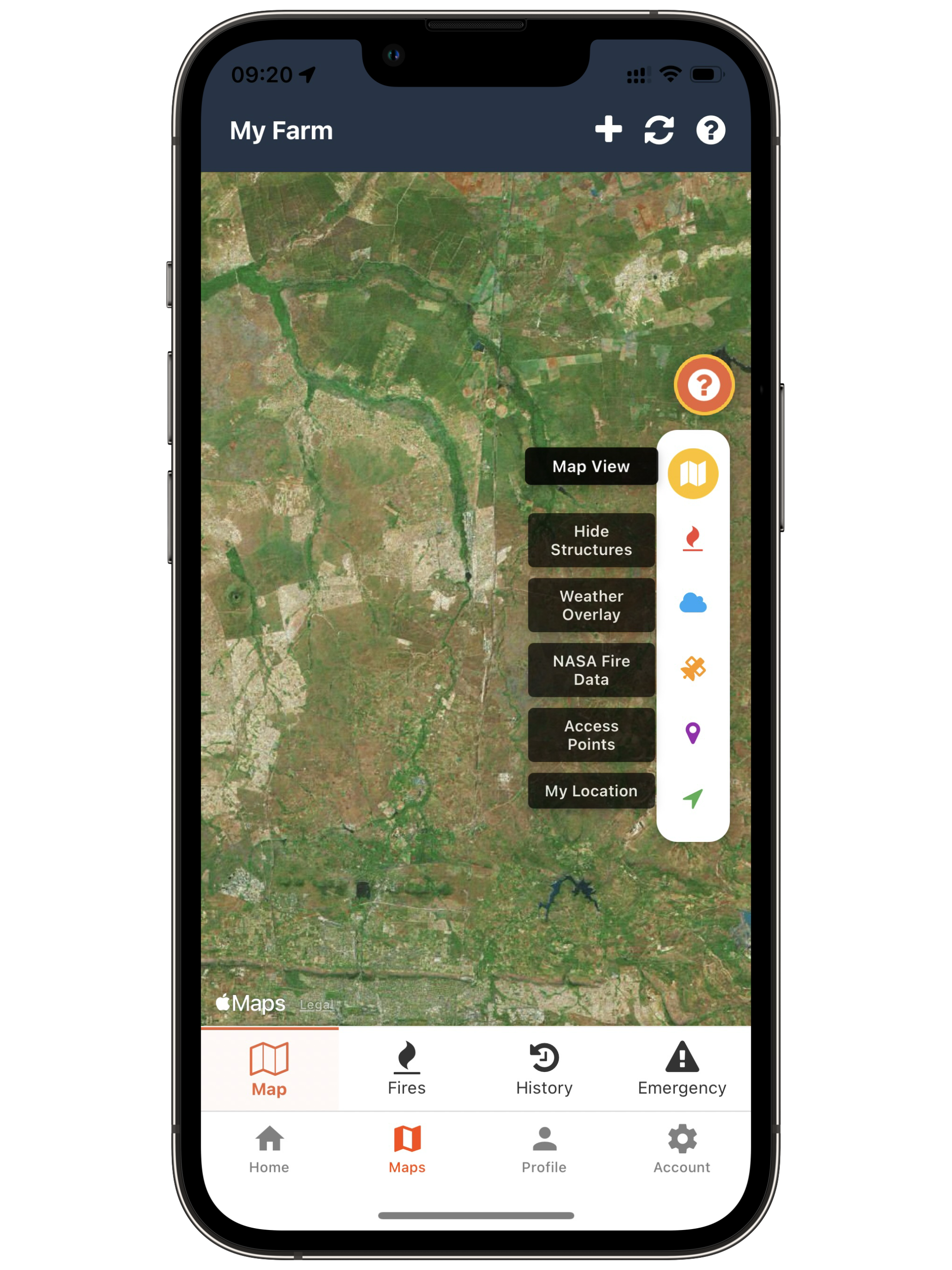
Farm Mapping
Easily draw and save your farm boundaries with GPS precision
Two decades of expertise, one powerful app.
We harness the power of technology, teamwork, and real-time intelligence to detect, fight, and outsmart wildfires – before they become disasters.
Our Mission
To empower communities, emergency responders, and environmental stakeholders with real-time tools to detect, manage, and mitigate wildfires – protecting lives, property, and ecosystems through innovation, early warning, and coordinated response. From early alerts to rapid response, our app puts life-saving action in the hands of communities, turning fear into firepower.
Our Vision
To ignite a future where no wildfire goes undetected, and every community is armed with the technology to stay safe, strong and unstoppable — building fire-resilient communities through smart, fast, and collaborative wildfire management.
Protecting South African Farmlands
Our proven track record in wildfire management and the technology behind MAP DE FIRE
Ready to Protect Your Land?
Be among the first in South Africa to use MAP DE FIRE and protect your property. Download the app today for instant access to advanced wildfire protection